All 4 stops
The site day
Longtail with lunch
- Length6 hours
- Phra NangLast stop, after lunch
- GroupPrivate option exists
- From$31
Choose your stop
4 Islands day trip by longtail boat from Krabi
★ 4.6 · Rated by 5,923 guests
Find out about 23 stops
Pick a route and tap a pin or a stop: you get its note and a Google Maps link.
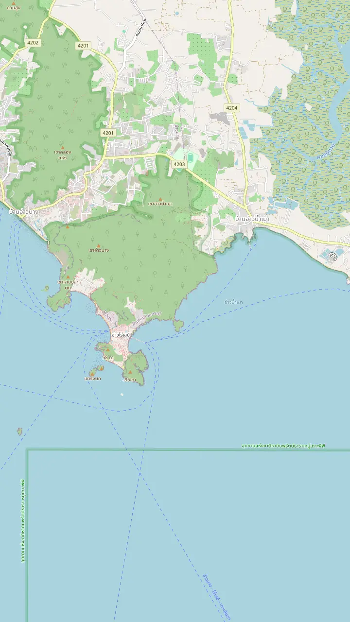
Railay West, the beach on the sea side of the peninsula. TAT says Railay is reached only by boat.
Google MapsRailay East, on the mangrove and pier side of the peninsula.
Google MapsPhra Nang Beach, the cove below the Railay cliffs, drawn here as TAT places Tham Phra Nang Beach inside the national marine park.
Google MapsPhra Nang Cave, listed by the park among its sites, with a small shrine at the beach.
Google MapsDiamond Cave, a cave stop of some Railay-focused tours.
Google MapsKo Rang Nai, an islet off the Railay shore.
Google MapsAo Nam Mao Pier, the meeting pier a tour record names when Railay pickups are suspended in the monsoon.
Google Maps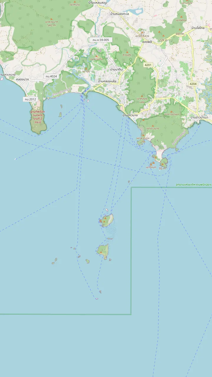
Ao Nang Beach Pier, the beach end of the Ao Nang strip; the park also lists Ao Phra Nang Pier for boats.
Google MapsPhra Nang Beach, the cove below the Railay cliffs, drawn here as TAT places Tham Phra Nang Beach inside the national marine park.
Google MapsPoda Island, where the park keeps ranger station number 6.
Google MapsTup Island, whose sandbar the tour record names; the park places Thale Waek around Ko Poda.
Google MapsChicken Island, which TAT also writes Ko Gai and counts among the islands renowned for an uncommon shape.
Google MapsKo Ya Wa Sam, an extra snorkelling stop on some tours.
Google Maps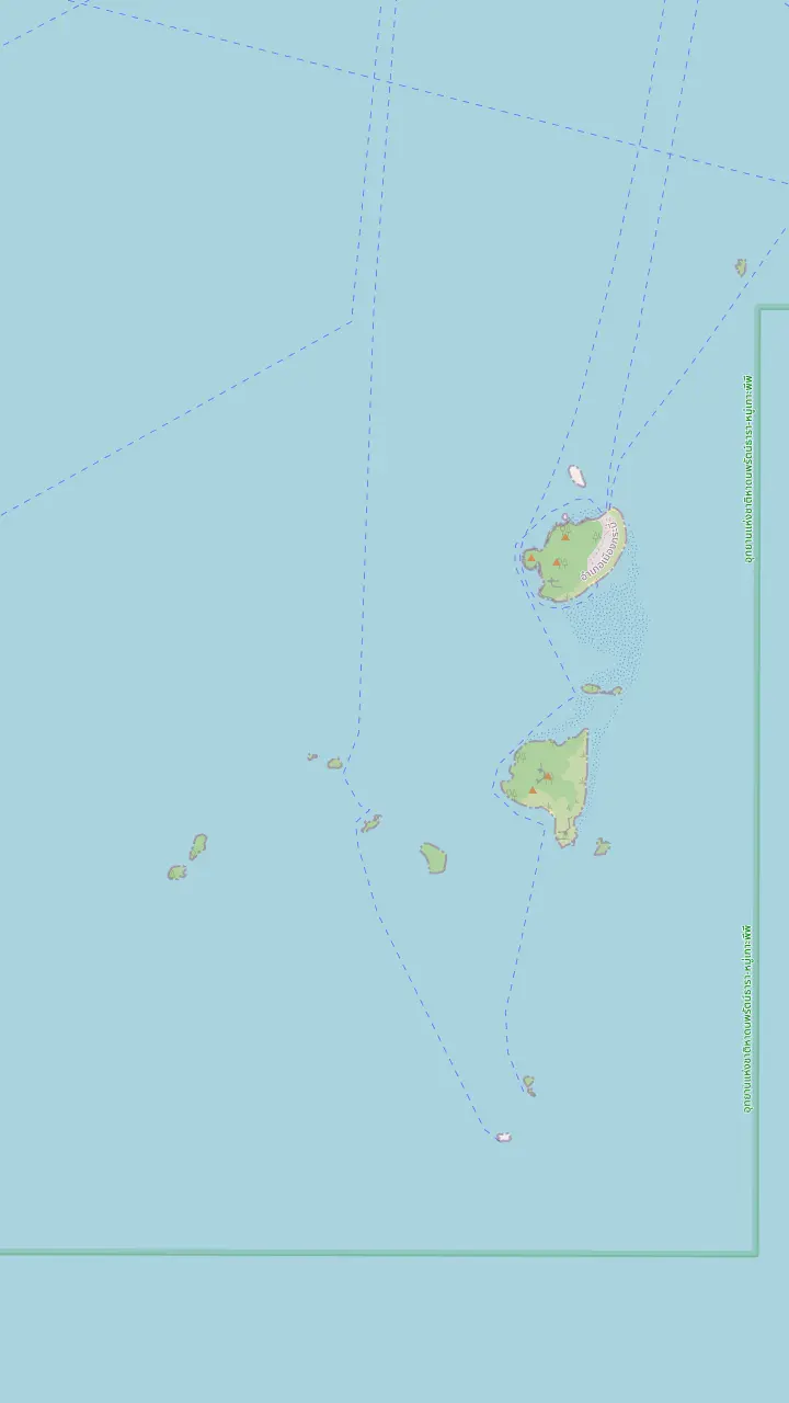
Poda Island, where the park keeps ranger station number 6.
Google MapsTup Island, whose sandbar the tour record names; the park places Thale Waek around Ko Poda.
Google MapsChicken Island, which TAT also writes Ko Gai and counts among the islands renowned for an uncommon shape.
Google MapsKo Ya Wa Sam, an extra snorkelling stop on some tours.
Google Maps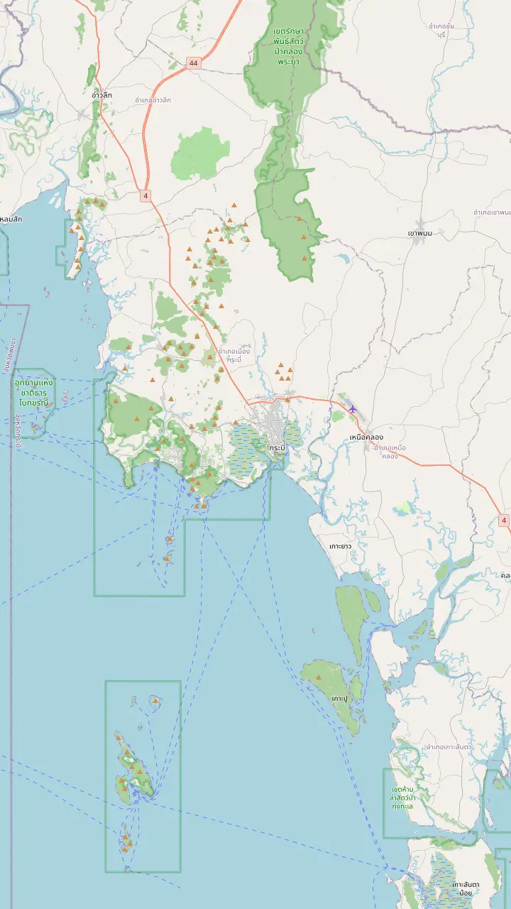
The airport of Krabi province, the usual arrival point for island trips from Ao Nang.
Google MapsChao Fa Pier in Krabi Town, one of the two piers the park lists for boats leaving Krabi Province.
Google MapsAo Nam Mao Pier, the meeting pier a tour record names when Railay pickups are suspended in the monsoon.
Google MapsAo Nang Beach Pier, the beach end of the Ao Nang strip; the park also lists Ao Phra Nang Pier for boats.
Google MapsNopparat Thara Pier, at the north end of Ao Nang near the park headquarters.
Google MapsRailay East, on the mangrove and pier side of the peninsula.
Google MapsMap source: © OpenStreetMap contributors
A map of the names on the boat ticket, and a close look at the stop that is a beach under limestone cliffs, not an island: the cove, the cave and the shrine.
Editorial team, krabi4islandstour.click · Updated November 16, 2026 · 9 min of reading
Quick look
The list of islands on a Krabi 4 Islands tour sounds simple, and then you read a handful of listings and meet a handful of different lists. The record of the day sold on this site lists Chicken Island, then Koh Tup (Thale Waek is its other name), lunch on Koh Poda and a final landing at Phra Nang Cave Beach in Railay. Chicken, Tup and Poda are islands. The last name on the ticket is a beach, which is why people who count the dots on a map arrive at a different number from the booking page.
Other products stretch or reshuffle the list. A record adds Koh Mor, a stop of 15 minutes that follows a walk on Thale Waek, and a sunset product visits Ko Ya Wa Sam, Ko Ma Tang Ming and Ko Rang Beach as well. A Phi Phi combination folds Chicken Island and Ko Poda into a day that is mostly about Maya Bay. The islands list you remember from a blog may belong to a different tour from the one you booked. Read the stop list on your own confirmation before you trust a list from elsewhere.
The park authority gives a neutral anchor for the names. Its own list of sites includes Ko Poda, Phra Nang Cave and Thale Waek,4,2 and TAT mentions Chicken Island, written Ko Gai, and Ko Poda as islands noted for their beauty or their shape.5 Read the stop list on your own confirmation, then use the map above to see where each name sits. The pins give you the geography in a glance: most of the names float in open water south of Ao Nang, while the cove hugs the cliff.
Compare the listings
| Tour type | Phra Nang Beach | Cave shrine | Where it falls |
|---|---|---|---|
| Site longtail day | Not given | Named stop | Last, after lunch |
| Longtail or speedboat | 50 minutes | Not listed | Opening stop |
| Speedboat with lunch box | 45 minutes | 15 minutes | Near the end |
| Car and longtail day | Not listed | 30 minutes | Last stop |
| Longtail with buffet | 45 minutes | 15 minutes | After the Railay hop-on |
| Phra Nang focused trip | 1 hour | Walk of 10 to 15 minutes | The core of the day |
| Sunset junk | 20 minutes | Not listed | Last stop |
Stop lengths follow each record; the schedule of your own boat comes from the operator.
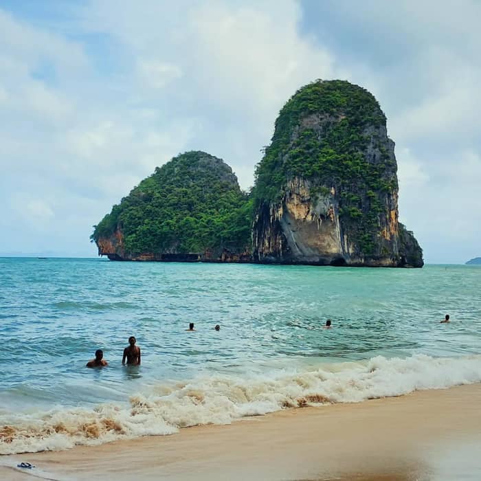
Phra Nang Cave Beach lies on the Railay peninsula, a headland cut off from Krabi Town by limestone cliffs and the sea. TAT describes Railay Beach as accessible only by boat,1 and a TAT photo caption places Tham Phra Nang Beach on Nang Bay inside the Hat Noppharat Thara national marine park.7 That explains the way the stop works on the tour: the longtail does not tie up to a village jetty but noses onto the sand of a cove.
The setting is what most people remember. TAT calls Railay known worldwide for vertical cliffs and turquoise water,8 and its Krabi feature praises the cave and the small beach beside it.9 Stand on the sand and the cliff is a wall behind you, the water is clear enough to read the bottom, and the islets of Ko Rang sit out in the bay. Bring a hat, as the cove offers little shade.
The park's visitor list helps with naming. It lists Khao Hang Nak, Phra Nang Cave, Wai King Cave, also called Phayanak Cave, and Thale Waek side by side,2 so the cave on this beach belongs to the same managed park as the sandbar and Poda. Keep the names of the 4 islands in Krabi straight when you compare tours, since the beach and the islands are the same on most boats. On a boat tour you meet the cove as a short swim-and-wander stop between the island stops, never as a day of its own, and the park's rangers look after it in the same way as the sandbar, so the same simple conduct rules apply to every stop of the trip.
Time on the sand
Minutes at the beach as listed; the Phra Nang focused trip gives it 1 hour.
Phra Nang Cave is a small cave at the foot of the cliff, and what draws people in is the shrine. A Railay-focused listing mentions a small shrine inside the cave and a nature walk to reach it from the floating pier, while the day-trip listings name a Phra Nang Cave Shrine as a stop of its own, from 15 to 30 minutes. The shrine stop is brief: there is little to do there except look, make a quiet offering if you wish and move on.
Treat the shrine as a place of worship. Speak softly, leave the offerings and carvings untouched, and wait your turn for photographs rather than reaching past someone who is praying. A cover-up for shoulders and knees is a sensible companion after a swim, and a dry shirt in the day bag costs nothing. The guide on your boat can tell you what the local fishing community leaves there and what is better left alone.
Photography needs a little tact as well. People come to the cave to pray and also to be photographed in front of the cliff, and both groups share a very small space. Step aside to take a picture, ask before pointing a lens at someone, and keep drones in the bag. If you want the cave without a queue, the longtail arrival schedule decides it: listings that visit early or late in the day meet fewer boats than those that arrive at midday.
Pick your stop
Tell us what draws you to the cove, and we point you to a trip.
If I want the shrine and the cave
A cave-focused trip
A listing built around the cave gives the beach 1 hour and a short walk to the shrine.
If I want every stop in a day
The site longtail day
Its record names Chicken, Tup, Poda and the cove in 6 hours.
If I want a long swim
A trip with 45 minutes or more
Several listings give the beach 45 to 50 minutes, so ask for the schedule.
If I want to climb or hike Railay
A separate day
TAT points to Railay for climbing, which the boat stop does not include.10
If I am travelling in the monsoon
Check the landing
Railay pickups can be suspended, and boats can be cancelled at the last minute.11
Ways to meet the cove
All 4 stops
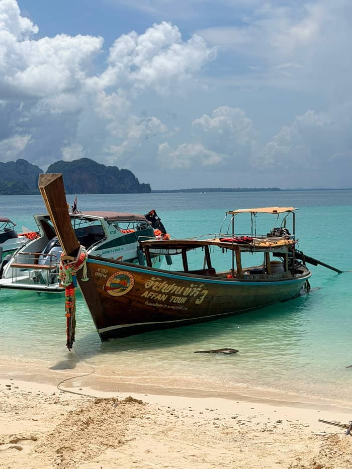
Longtail with lunch
More time ashore
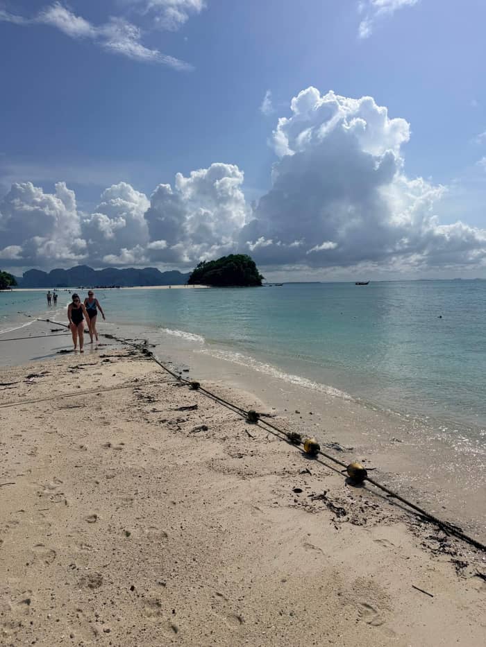
Walk to the shrine
Short boat legs
Lunch box included
If the stop leaves you wanting more of the peninsula, TAT has a short summary. It says Railay has limestone peaks that are probably the best rock climbing spot in Thailand, plus beautiful beaches, the Princess Cave, and Tonsai Beach with its monkeys.9,10 In its Andaman roundup TAT adds that climbers come for the limestone while everyone else comes for beaches and quiet coves.15 The tour touches only the cove, so the rest is for another day.
A listing shows how a Railay-focused outing is built around the cave. It spends 1 hour at Phra Nang Beach, adds Diamond Cave, and ends with 1 hour at Railay Beach for the sunset. Those minutes are generous compared with the 4 islands day, where Phra Nang is a stop among several. If the cove is the part you care about, a trip like that gives it room, while the islands day gives you the full tour of the limestone islands.
The park runs an information service center at Railay,3 which is the place to ask about trails, closures and conduct rather than a stranger's blog. TAT also notes that the limestone karsts of Railay are, it says, more and more visited with eco-certified operators who apply low-carbon methods to climbing and boat trips.16 Whichever way you come, leave the cave floor as you found it and take your rubbish back to the boat, as a cove this small shows every wrapper.
A visit to the cove
Arrival
The longtail comes to the sand of a cove reached only by water.1
Swim
The water off the beach is clear; look for stonefish and urchins before wading.6
Walk
The shrine stop is listed from 15 to 30 minutes where it appears.
Time out
Listings give the beach 45 minutes or more on longer stops.
Departure
The guide calls the group together; the record says the day may change with the weather.
Boat tours differ more on this stop than on any other, and that makes it worth a minute of comparison before you book. Across the listings in the chart below, time on Phra Nang Beach runs from 20 minutes on a sunset junk to 1.5 hours on a sunset longtail, and the cave shrine, where it is listed as its own stop, adds 15 to 30 minutes. The site's own record does not give a time for the stop, so ask the operator when you book.
Where the beach falls in the day matters as much as the minutes. The site's record lists Phra Nang Cave Beach last, after lunch on Poda, while a speedboat listing starts at Thale Waek and visits Phra Nang near the end, and another longtail listing starts at Railay with a hop-on stop and goes straight to the beach for 45 minutes. A cove at the end of the day tends to be calmer once most boats have gone, while an early cove can be quiet for a different reason.
Boat legs eat into the clock. A speedboat listing counts 20 minutes of travel at each end of its 5.5 hour day, and the site's record counts 6 hours in all. If you plan to swim, take the shrine walk and still have time to sit with a drink, favor a listing that gives the beach 45 minutes or more, and pair it with a morning start so the cove is not in direct afternoon glare. Whatever you choose, ask the crew to point out where the boat will wait and how the group will be counted, so nobody is left looking for the right longtail on a beach with several.
Video
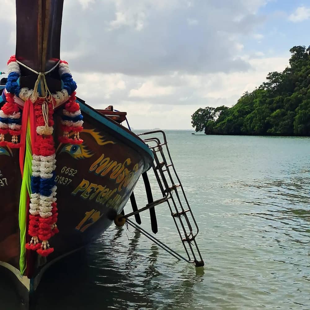
Drone Away on YouTube · The clip loads only after you tap play.
the superb Phra Nang Cave and its charming little beach, the Princess Cave, Tonsai Beach and its monkeys
Before you land
The cove is not only scenery. The park's species list names Brahminy kites and white-bellied sea eagles among its birds,17 and a Railay-focused listing warns of monkeys along the trail to the cave. TAT mentions Tonsai Beach and its monkeys in the same stretch of coast.9 Wild monkeys take food and bags, so keep snacks zipped away, and never offer food: TAT states that feeding fish and handling marine life are strictly forbidden in the same park system.14
Underwater the story is the same as on the other islands. The park's coral list runs from finger to flower to staghorn types,18 marine angelfish and wrasses among the fish,19 and sea stars, sea urchins and anemones among other marine life.20 Swimming off the beach is safe for most people on a calm day, yet you should still look where you put your feet, since TAT lists stonefish, weever fish and sea urchins among the marine hazards.6
Take the same care with the rest of the animals you meet. The park lists green, hawksbill and olive ridley turtles among its reptiles,21 and TAT warns that jellyfish stranded on a beach can still sting.22 A calm look is enough: never chase a turtle or a monkey for a better photograph, and keep a respectful distance from any bird nest or perch you notice on the rocks. The wildlife is part of why the park exists, and the cove is a good place to practise watching without touching.
Landing on the beach is the part that changes with the sea. TAT frames the monsoon as a May to October affair, and island trips keep sailing, although a crew may call off or postpone a departure.23,11 One evening product goes further: its Railay pickups and drop-offs stop in the monsoon and guests head to the Ao Nam Mao Pier instead. Read the pickup line of your booking for that reason, particularly between May and October.
A rough day does not always cancel the trip, and the decision rests with the boat. TAT says a cancellation is generally the captain's call, and it advises checking island crossings on an hourly basis even when a ticket is already bought.24,25 The site's own record adds a warning that the day can be altered by the weather. A cove with a shallow slope can still have surf on the sand after a windy night, so go by what you see and by the guide's instructions.
If you are visiting in the drier months, TAT looks for settled dry weather from December and calls October and early November uncertain.26,27 The park's own figures put its rainy season from May to December, with July the wettest month.28,29 Set side by side, the sources suggest the safest plan is to leave a spare day in your itinerary and to book a cancellable ticket so that a swell does not cost you the day.
FAQ
A listing built around the cave mentions the shrine and a walk of 10 to 15 minutes to reach it from the pier.
Stops range from 20 minutes on a sunset junk to 1.5 hours on a sunset longtail, plus 15 to 30 minutes at the cave shrine where it is listed.
TAT says Railay is probably the best rock climbing spot in Thailand, but the boat only stops at the beach, so a climb needs a separate day.10
The park lists a Railay Information Service Center among its facilities.3
A Railay-focused listing mentions monkeys along the walk, and TAT mentions monkeys at Tonsai Beach nearby.9
An evening listing drops its Railay pickup and drop-off in the monsoon and meets guests at Ao Nam Mao Pier instead.
Sources
Also worth reading
Planning the 4 Islands trip? Ask a real person here.