All the stops
The site day
Longtail with lunch
- Length6 hours
- SandbarNamed in the record
- SnorkelEquipment provided
- From$31
Choose your stop
4 Islands day trip by longtail boat from Krabi
★ 4.6 · Rated by 5,923 guests
Find out about 23 stops
Pick a route and tap a pin or a stop: you get its note and a Google Maps link.
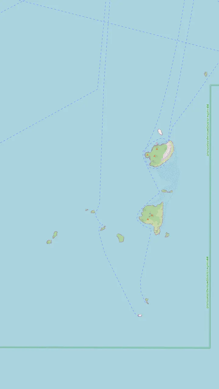
Poda Island, where the park keeps ranger station number 6.
Google MapsTup Island, whose sandbar the tour record names; the park places Thale Waek around Ko Poda.
Google MapsChicken Island, which TAT also writes Ko Gai and counts among the islands renowned for an uncommon shape.
Google MapsKo Ya Wa Sam, an extra snorkelling stop on some tours.
Google Maps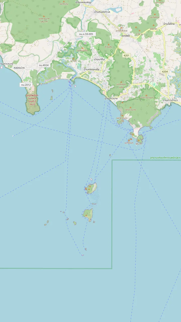
Ao Nang Beach Pier, the beach end of the Ao Nang strip; the park also lists Ao Phra Nang Pier for boats.
Google MapsPhra Nang Beach, the cove below the Railay cliffs, drawn here as TAT places Tham Phra Nang Beach inside the national marine park.
Google MapsPoda Island, where the park keeps ranger station number 6.
Google MapsTup Island, whose sandbar the tour record names; the park places Thale Waek around Ko Poda.
Google MapsChicken Island, which TAT also writes Ko Gai and counts among the islands renowned for an uncommon shape.
Google MapsKo Ya Wa Sam, an extra snorkelling stop on some tours.
Google Maps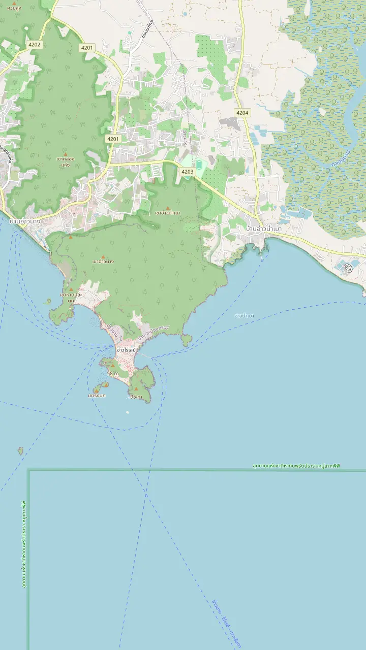
Railay West, the beach on the sea side of the peninsula. TAT says Railay is reached only by boat.
Google MapsRailay East, on the mangrove and pier side of the peninsula.
Google MapsPhra Nang Beach, the cove below the Railay cliffs, drawn here as TAT places Tham Phra Nang Beach inside the national marine park.
Google MapsPhra Nang Cave, listed by the park among its sites, with a small shrine at the beach.
Google MapsDiamond Cave, a cave stop of some Railay-focused tours.
Google MapsKo Rang Nai, an islet off the Railay shore.
Google MapsAo Nam Mao Pier, the meeting pier a tour record names when Railay pickups are suspended in the monsoon.
Google Maps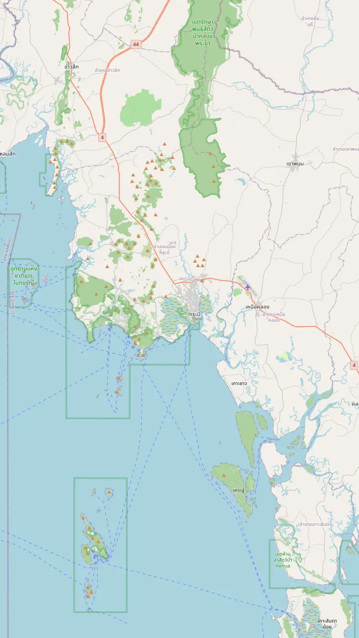
The airport of Krabi province, the usual arrival point for island trips from Ao Nang.
Google MapsChao Fa Pier in Krabi Town, one of the two piers the park lists for boats leaving Krabi Province.
Google MapsAo Nam Mao Pier, the meeting pier a tour record names when Railay pickups are suspended in the monsoon.
Google MapsAo Nang Beach Pier, the beach end of the Ao Nang strip; the park also lists Ao Phra Nang Pier for boats.
Google MapsNopparat Thara Pier, at the north end of Ao Nang near the park headquarters.
Google MapsRailay East, on the mangrove and pier side of the peninsula.
Google MapsMap source: © OpenStreetMap contributors
Where the rock that looks like a bird stands, how the sandbar at Thale Waek comes and goes with the water, and what to ask your operator before the boat leaves the pier.
Editorial team, krabi4islandstour.click · Updated November 16, 2026 · 9 min of reading
Quick look
When someone asks what the 4 islands of Krabi are, the straight reply is a brief list plus a caveat. On the tour sold here the record names Chicken Island, Koh Tup, which it also calls Thale Waek, Koh Poda, and the beach at Phra Nang Cave in Railay. Chicken and Tup are the stops that sit closest together, in the water south of Ao Nang, and the map above shows how little open sea lies between them and Poda.
The caveat is that boats combine these places differently. A longtail listing gives Tup Island 30 minutes, Chicken Island 30 minutes and Koh Mor a further 15 minutes, while a speedboat listing gives Thale Waek 45 minutes and Ko Tup only 15. Neither is wrong; each one simply splits the same patch of water into stops in its own way, and the sandbar is the reason the names overlap.
This page stays with the pair of stops that people mix up most. Phra Nang and Poda have pages of their own, and the park authority is the neutral source for the shared geography: it lists Thale Waek and Ko Poda among its sites and runs an information service center at Thale Waek.3,4 Use the pins above to see Chicken, Tup and Poda close up before you decide which listing to book, and compare the stop times in the table further down the page.
Compare the stops
| Tour type | Chicken Island | Tup Island | Thale Waek |
|---|---|---|---|
| Longtail or speedboat | 30 minutes | 40 minutes | Not listed |
| Speedboat with lunch box | 40 minutes | 15 minutes | 45 minutes |
| Car and longtail day | 45 minutes | 15 minutes | Not listed |
| Longtail with buffet | 30 minutes | 30 minutes | 45 minutes |
| Sunset with BBQ | 30 minutes | 1 hour | Not listed |
| Sunset with dinner | 15 minutes | 30 minutes | Not listed |
Minutes come from each listing's record; the site's own record names the stops without minutes.
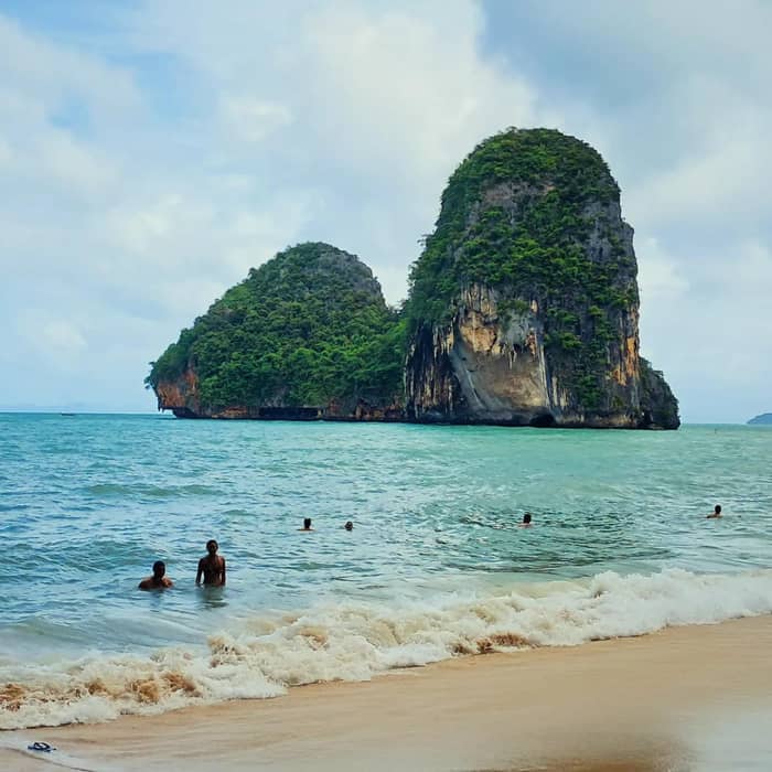
Chicken Island is the stop people photograph for the profile. TAT writes the name as Ko Gai and puts it, with Ko Poda, among islands renowned for their beauty or their uncommon shape.1 The park spells it Ko Kai in its water-quality notes and records boats travelling there with no oil or grease on the surface.5 Seen from the water at the right angle, the rock reads as a bird with a raised neck, which is where the English name comes from.
What you do there depends on the listing. The site's record names Chicken Island ahead of the other stops and lists snorkeling there. A longtail listing gives the island 30 minutes for swimming and snorkeling, a speedboat day gives it 40 minutes, and a sunset junk gives it 1.5 hours with kayaking and paddleboarding. A day that treats the island as a photo stop for 15 minutes, as one sunset record does, is about the view, not the water.
The rock is a limestone island, and the park explains the general rule: most of its island limestone formed in the Permian period within the Ratchaburi Formation.6 That geology gives the steep sides, the undercuts and the small caves you notice from the boat. Keep your distance from the cliff, do not climb onto the rock, and leave the nesting birds and bats alone. A clean view comes from the boat or from the water, and it costs the rock nothing.
Time on the rock
Minutes at the island as listed; a sunset junk gives it 1.5 hours, which is left off the chart.
A sandbar is a strip of sand just below or just above the surface, and on this tour it is the main event of the stretch before lunch. The site's record says a sandbar joins Koh Tup to Koh Mor at low tide, and a sunset record says the sandbank also joins Tup to Chicken Island and Mor Island. People call it the Chicken Island sandbar on a Krabi 4 Islands tour, and the records tie it to Tup Island. The records describe the chain slightly differently, so treat the exact links as what the water shows on the day rather than as a fixed route.
The park gives a useful official frame. It calls Thale Waek around Ko Poda an area with interesting geomorphology,2 and it describes a general tower karst coast with sandstone layers, where many islands collect sandy beaches along their coves.8 The same park singles out a sandbar between Ko Nai and Ko Nok in the Phi Phi Don area as another example.9 In short, sandbars are a known feature of this coast, and Thale Waek is the one your boat visits.
Thale Waek is not only a place name on a map. The park runs an information service center there,4 and its water survey found the spot crowded with boats and visitors, with no oil or grease on the surface.10 Expect company on the sand. If you want a quieter walk, ask the operator whether the sandbar stop falls early or late in the day, as the listings place it in different spots in the order, and an early or late slot can mean fewer boats.
Choose your listing
Say what you want from the rock and the bar, and a trip comes up.
If I want to walk the sandbar
A listing with Thale Waek as a stop
Speedboat and longtail listings name it as a stop of 45 minutes.
If I want to snorkel at the rock
A longtail or speedboat day
Listings give Chicken Island 30 to 40 minutes with snorkeling.
If I want a long swim
The sunset junk
Chicken Island is allowed 1.5 hours here, with kayaks and paddleboards on board.
If I want photographs of the rock
A short photo stop is enough
A sunset record gives it 15 minutes as a photo stop.
If I am visiting in the monsoon
Keep the day flexible
A trip may be scrapped or held back late.7
Ways to book the pair
All the stops
Longtail with lunch
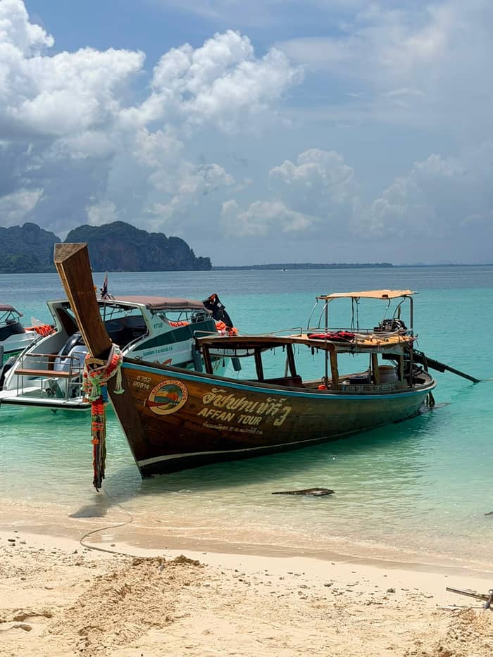
Thale Waek stop
Lunch box
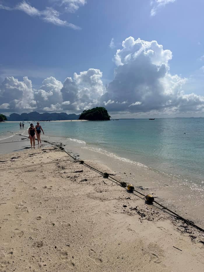
Adds Koh Mor
Thai buffet lunch
Everything about the sandbar depends on the water level, and no operator can promise a walk. A listing that stages the stop at low tide is describing what the sea allows at the time, not a guarantee. On a high-water day the bar can lie under the surface and the stop turns into a swim and a photograph from the boat. On a low-water day you step off, walk on wet sand and look back at the island you left.
Do your own homework in a few minutes. Look up a tide table for Krabi for your date, see whether low water falls in the middle of the day, and ask the operator which stop the boat makes when the bar is covered. The practical rule is to read a tide table and to do what the guide says once you are there. Do not try to wade across a channel on your own: the water over a bar can deepen when the tide returns, and a group that wanders off is hard to count.
Speed and route change the odds too. One speedboat product opens at Thale Waek for 45 minutes and moves on to Ko Tup for 15, while a longtail listing walks Thale Waek for 45 minutes after Chicken Island. If the bar matters to you, choose a listing that lists Thale Waek as its own stop, as those listings do, and message the operator to ask what they do on a day when the tide is wrong.
A sandbar day
High water
The boat anchors near the shore and the stop becomes a swim and a view.
Falling tide
A strip of sand rises between the islets and the guide checks the depth.
Low water
The record describes a sandbar joining Koh Tup to Koh Mor at low tide.
Rising tide
The group returns before the water covers the bar again.
The sandbar is a photographer's stop, and the light decides how it looks. Around midday the sand glares, the water is flat turquoise and shadows vanish, which suits wide shots with a boat in the frame. A boat that reaches the bar earlier or later gets softer light and longer shadows. You cannot choose the light on a shared tour, but you can choose a listing whose order puts Thale Waek where the sun is lower.
Wear shoes you can get wet, or go barefoot on the sand and keep a pair of sandals in the bag for the rocks near the shore. A dry bag protects a phone from a wave across the bar, and a wrist strap is cheaper than the dive for a camera. Stay in the group's shallow tracks, as the edge of a bar can drop away. If you pick up a shell, put it back, as TAT states that handling starfish and other marine life is strictly forbidden.16
Keep a sense of scale when you pose. The walk between islands is short, the boats waiting at the edge are the reason for a headcount, and the sand is wetter than it looks. The park's own survey found the area crowded with boats and visitors,10 so a frame with nobody else in it needs patience or an early start. A small tripod is not necessary, but a steady hand and a slow shutter in bright light are, and your guide can point out the angle where Chicken Island and the bar line up. Spend a minute looking before you shoot, then put the camera away and enjoy the strange feeling of standing in the sea.
Video
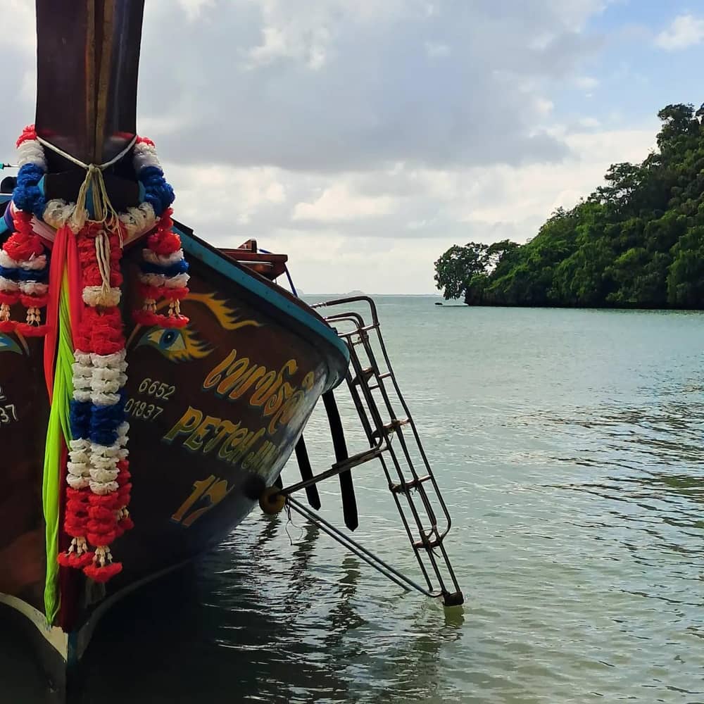
Drone Away on YouTube · The clip loads only after you tap play.
An area with interesting geomorphology is Thale Waek around Ko Poda
Before the sandbar
Chicken Island is where several listings put the snorkeling. The site's record lists provided equipment and a snorkel at Chicken Island, and among the corals the park has recorded are finger, flower and staghorn types.17 A calm patch beside the rock is a good place to watch fish. For the full guide to gear, life vests and reef conduct, use the snorkeling page of this site; here the short rule is to float, look and do not touch.
TAT reports a rule that snorkelers beside coral reefs be given life vests and keep them on throughout, except certified freedivers.18 The rule comes from the Ministry of Natural Resources and Environment and took effect on 22 April 2025.19 A stop with coral is where it counts. If the crew hands you a vest, wear it, even if you swim well. Do not stand on coral, and keep fins well off the bottom around the rock.
Currents run around a small island, and the water is clearer on a calm day. If the crew says no swimming, it is a safety decision, not a sales one. TAT advises that red flags mean do not swim, and yellow flags mean swimming is allowed with medium risk.20,21 The same rule applies to a beach flag at any stop of the day, so look at the shore before you step off the boat.
The sea decides this pair of stops more than any other. TAT notes that island-hopping departures carry on through the Southwest monsoon, May to October, yet any of them may be scrapped or held back late.22,7 On a lumpy day a sandbar stop may be dropped entirely, and a boat may stay in sheltered water near Poda. The site's own record flags that conditions at sea can change the day's plan.
The park's own figures help with the planning: its rainy season runs from May to December, and July is the wettest month.23,24 TAT treats December as the start of the dry season and says October and early November can stay damp.25,26 If the sandbar is the point of your day, a month in the drier season is the safer pick, but the tide still decides on the day. A calm morning in the dry months with a low tide at midday is the combination that makes the stop shine.
A rough forecast is not a reason to stay home, and it is not a reason to push on either. Read the pickup message from the operator, and follow the captain's call, which TAT says is generally the decision of the boat's captain.27 The site's record offers free cancellation up to 24 hours in advance, which suits a plan that depends on the water.
FAQ
The site's record names Chicken Island, Koh Tup also called Thale Waek, Koh Poda and the beach in Railay.
TAT writes it Ko Gai and lists it among islands noted for an uncommon shape.1
The site's record ties the sandbar to low tide, so a high-water day can leave it under the surface.
Listings give 15, 30, 40 or 45 minutes, and a sunset junk gives it 1.5 hours.
The site's record, a longtail listing and a speedboat listing all list snorkeling there.
Yes: operators must supply vests for coral-reef snorkeling, and guests keep them on, certified freedivers aside.18
Sources
Also worth reading
Planning the 4 Islands trip? Ask a real person here.